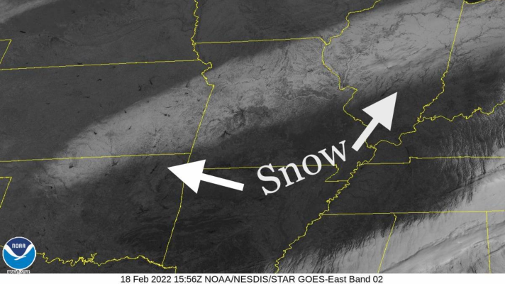
Clear skies allowed the latest Chicago snowfall to be seen from the GOES East satellite as a result of Thursday’s snowstorm. The snowfall can be seen in images as an elongated area stretching from northern Oklahoma into Illinois.

The Chicago National Weather Service (NWS) office reports that Thursday’s storm officially dumped 2.9 inches of snow at O’Hare Airport. Across the area snow totals varied from 2-5 inches with 3.8 inches reported near Midway and 4.1 inches reported at the Chicago NWS office in Romeoville.

Because snow is highly reflective in direct sunlight it shows up very well in visible satellite imagery. The snow often highlights features such as lakes, rivers, and valleys. This visible image is one of two “channels” that the GOES satellite uses to observe the Earth. The images come from the Advanced Baseline Imager (ABI) which views the Earth with 16 different spectral bands, the visible being two of them.

The GOES East satellite does not orbit the Earth but sits at a stationary point 22,300 miles above the Earth’s surface. This is what makes it a geostationary satellite. GOES East was launched in 2016 followed by GOES West in 2018. They are the latest advanced weather satellites. The next in the series GOES-T will be launched in March and replace GOES West which has a problem with its ABI instrument.
Related: The Problem with GOES West
This article was previously published by Michael Galindo on ChicagoNow.

