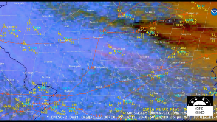
Illinois is typically known for its snowstorms, not dust storms which commonly occur in the American Southwest or the Central Plains states. But on May 1, a dust storm captured by the GOES-East satellite caused a 72-car pileup on Interstate 55 just south of Springfield, IL. The cause of the crash was blowing dust from nearby farm fields that reduced visibility to zero.

The GOES-East satellite detected the dust storm using one of its Red Green Blue (RGB) products, called Dust RGB, specifically designed to detect dust. RGB products are created by combining two or more Advanced Baseline Imager (ABI) bands into RGB color components. When combined in a specific way, these images can highlight atmospheric and surface features that are usually more difficult or time-consuming to distinguish by looking at individual ABI bands.

The dust signature was initially detected around 11 am and continued until about 4 pm when clouds obscured the area. Weather stations in the vicinity of the crash recorded peak wind gusts as high as 54 mph.

According to the Central Illinois National Weather Service (NWS) Office, when dust storms occur in Illinois, they typically happen in May and early June. According to news reports, nearby fields in the area of the crash had recently been tilled, leaving loose topsoil exposed to the high winds that day.

GOES-East was launched in November 2016 aboard an Atlas V from Cape Canaveral Space Force Station in Florida. Data and images from GOES satellites monitor more than the weather. Everything from volcanic activity, wildfire detection, solar activity, Earth’s magnetic field, and search and rescue operations are monitored using space satellites.

